

 0
0
 0
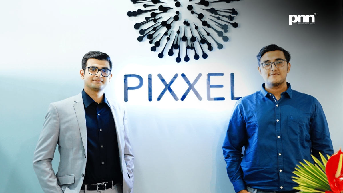
0 New Delhi [India], September 7: Pixxel has raised $100 million in a Series C round led by Temasek and Seraphim, taking its total funding to $195 million. The Google-backed space technology company announced the financing on September 7 as it prepares to expand its satellite and Earth intelligence operations. Reuters reported the announcement as the largest single funding round raised by an Indian space technology company.
The Pixxel funding round is a substantial business story. Its wider significance lies in a quieter problem: people responsible for land, water and infrastructure frequently have to decide what to investigate with incomplete information. An observation from space becomes valuable when it makes that decision better.
Consider an agricultural adviser deciding which fields to visit after reports of uneven crop growth. A photograph might show where the fields are. A more specialised observation might help identify differences within them. The adviser still needs local knowledge, weather records and field checks. But a well-founded indication of where to look could change the day’s work.
That is an illustrative example, not a reported Pixxel customer outcome. It captures the commercial proposition behind Earth intelligence: convert a large, difficult-to-interpret view of the planet into information that somebody can use.
For Pixxel, the challenge now stretches across engineering, software and customer adoption. The company must build dependable instruments, produce interpretable data and make the resulting service worth returning to. Each part has a different test of success. Getting a satellite into orbit is measurable; becoming part of a customer’s everyday decisions takes longer to establish.
The investment gives the company resources to attempt that transition. It also makes the next stage more interesting to watch. Beyond the amount raised, the questions concern delivery: what will become available, which problems it will address, and how convincingly its users can judge the results.
What the Pixxel funding round includes
New investors 360 ONE Asset and IMM Investment participated alongside existing backers Radical Ventures and growX Ventures, according to reporting by The Economic Times. The participation brings together investors from several markets around a business with both Indian and international ambitions.
Google’s role deserves precision. The technology company joined Pixxel’s $36 million Series B in 2023. That earlier investment explains the description “Google-backed”; the newly announced round identifies Temasek and Seraphim as its leads. Pixxel’s 2023 announcement also described plans for satellite development and its Aurora analytics platform, showing that the connection between sensors and software predates this financing.
There are three different numbers a reader should keep separate in any funding story: the money raised in the latest round, the company’s cumulative funding, and the valuation assigned to the business. They answer different questions. One describes the present transaction, another describes financing over time, and the third concerns the price investors place on ownership.
A funding total also says little by itself about how much cash remains available. Earlier capital may already have supported research, salaries, facilities or launches. Understanding the company’s financial capacity would require additional information about spending, obligations and revenue.
For that reason, this announcement is best read as an expansion of financial resources and investor commitment. Its commercial consequences will depend on what those resources produce. A larger round can finance more work; customer demand and execution determine how much of that work becomes a durable business.
The roadmap: satellites, software and manufacturing
Pixxel’s September 7 announcement identifies four areas for expansion. The company plans to develop Honeybee hyperspectral satellites with shortwave infrared capabilities, add radar and very high-resolution optical sensing, expand Aurora, pursue sovereign Earth observation systems, and increase manufacturing capacity in India and the United States. Its first Honeybee satellite is expected to launch in 2027. These are announced plans and a target date.
That mix matters because it addresses several different customer needs. A buyer may care about the composition of a surface, the outlines of a structure, changes across a large area, or continued observation through cloudy conditions. Different instruments are suited to different parts of that work.
Building a broader offering also changes the organisational challenge. Hardware teams must develop and qualify instruments. Mission teams must plan observations and operate spacecraft. Data teams must make measurements consistent and understandable. Commercial teams must discover which capabilities customers will actually pay to use.
Those activities depend on one another, but they move at different speeds. A software feature can be revised after release. A component fitted to a spacecraft demands a different level of preparation. A customer contract may depend on a capability that is technically ready but still awaiting a launch opportunity.
The editorial reading of the roadmap is therefore straightforward: Pixxel is attempting to become responsible for more of the journey from an observation to its use. That creates opportunities to improve the whole service, alongside a greater coordination burden. The practical advantage will emerge if customers experience a coherent product across those separate disciplines.
What hyperspectral imaging actually measures
Hyperspectral imaging records light across many narrow wavelength bands. That gives analysts a more detailed spectral measurement than an image assembled from a small set of broad bands. NASA explains spectral resolution as an instrument’s ability to distinguish finer wavelength intervals, separate from the spatial resolution that determines the ground area represented by a pixel.
An everyday colour photograph compresses a scene into a familiar visual representation. Imaging spectroscopy preserves more information about how the observed surface interacts with light. The resulting patterns can help analysts distinguish materials that appear similar in a conventional view.
There is a substantial scientific foundation for interpreting those patterns. The US Geological Survey has measured the reflectance of thousands of materials and assembled spectral libraries for identifying and mapping minerals, vegetation and manufactured materials. Such reference measurements help connect a signal detected by an instrument with properties of the surface being observed.
It is helpful to imagine the difference between recognising the outline of a book and being able to inspect some of its contents. The outline tells you something real. Additional information answers a different class of question. In Earth observation, the relevant distinction is between the arrangement of features and the physical characteristics that can be inferred from their measured light.
The analogy has a limit: an instrument does not read an unambiguous label attached to every patch of ground. Analysts interpret measurements. A pixel can contain several materials, and the conditions under which the observation was made affect what the signal means. That is why a compelling image is the beginning of an explanation, rather than a complete result.
For readers evaluating a satellite business, this distinction is more useful than an impressive-sounding band count. The right question is which additional information those bands provide for a particular task, and whether the information remains dependable when conditions change.
Four ways of looking at Earth
Earth observation involves choices between complementary tools. This simplified comparison explains the roles; it is not a performance comparison of named commercial products.
| Observation type | What it contributes | A useful question |
| Conventional optical imagery | Recognisable shapes, boundaries and visible features | Where is the feature, and how has its appearance changed? |
| Multispectral imagery | Measurements across selected wavelength bands | How are land cover or vegetation patterns changing? |
| Hyperspectral imagery | Finer spectral detail that can support material and condition analysis | What additional surface characteristics can be inferred? |
| Synthetic aperture radar | Observations using radar, including through cloud and at night | What can be observed when daylight or cloud obstructs optical imaging? |
Pixxel’s own comparison of multispectral and hyperspectral methods describes the value of choosing spectral detail to fit the task. ESA’s Sentinel-1 documentation explains the separate contribution of radar’s day-and-night, all-weather imaging. Taken together, these sources support a practical conclusion: the instrument should follow the question being asked.
A city planning team mapping broad land-use change may have different requirements from a scientist examining vegetation chemistry. Paying for more spectral detail makes sense when the extra measurement improves the answer. A simpler dataset can be entirely appropriate when it already answers the question well.
This matters commercially because customers buy solutions within budgets. The most sophisticated sensor in a catalogue does not automatically produce the most suitable service for every project. A supplier that understands this can help a buyer make a defensible choice, including when several types of observation need to be combined.
The prospect of combining instruments is especially relevant to monitoring over time. One dataset might establish a broad pattern, another might reveal a more specific characteristic, and a field visit might resolve the remaining uncertainty. A well-designed service makes the relationship between those sources visible.
Firefly provides the operating starting point
Pixxel’s Firefly programme gives the expansion an existing platform. According to the company, three Firefly satellites launched in January 2025 and three more followed in August, completing the first phase of its commercial constellation. Its published specifications list five-metre ground sampling, more than 135 spectral bands and coverage in the 450–900 nanometre range.
The specifications describe different dimensions of an observation. Ground sampling concerns how the scene is divided spatially. Spectral coverage concerns which wavelengths are measured. A service also depends on when a usable observation is collected and how quickly it reaches the person who needs it.
Operational experience creates a different kind of learning from laboratory development. It lets a supplier discover which datasets customers request repeatedly, where delivery is difficult and what explanations users need. Those lessons can influence the design of a subsequent instrument as much as the ambition to improve a technical specification.
A useful way to assess the transition is to look for continuity between generations. Will customers be able to compare observations over time? Will familiar workflows remain understandable? Can the company explain where a new measurement adds information and where it requires a revised method?
These are questions for future delivery, rather than claims about deficiencies in the current product. They matter because customers build habits, budgets and decisions around a data service. The value of a new instrument increases when the company can help existing users understand how to incorporate it.
Why shortwave infrared adds a new dimension
Different wavelengths reveal different aspects of a surface. USGS’s high-resolution spectral library includes measurements of minerals, soils, rocks, vegetation and other materials across a wide spectral range. The scientific reason to expand wavelength coverage is to access additional diagnostic features, subject to the characteristics of the instrument and the material being observed.
NASA’s Earth Surface Mineral Dust Source Investigation, or EMIT, provides a separate example of imaging spectroscopy in practice. The instrument observes reflected visible and infrared light to map surface minerals in dust-source regions. The mineral composition matters to research on how airborne dust affects the Earth system. EMIT demonstrates the scientific usefulness of these measurements; its performance should not be transferred to a different company’s instrument.
For a commercial customer, the question is how the added information changes a project. A new wavelength range could be significant if it helps distinguish features relevant to the customer’s work. It could be less significant where cloud, timing, spatial detail or the availability of reference measurements remains the main constraint.
That makes the planned next generation an opportunity to test specific propositions. The strongest demonstrations will name the task, describe the conditions and show what improved. General promises about seeing more of the planet become more persuasive when accompanied by a precise account of what somebody learned.
There is room for optimism in that standard. A technology does not need to answer every possible question to become valuable. It needs to answer an important question reliably enough that a user can act on the result.
Aurora and the work between a satellite image and a decision
Aurora is Pixxel’s Earth observation software platform. The company describes a browser-based environment for exploring imagery, using models and indices, creating workflows and connecting through application programming interfaces. It also describes support for open and third-party datasets, alongside its own imagery. These are the company’s published product descriptions.
The business logic is easy to understand. A customer rarely wants to spend the working day locating files, checking their suitability and moving them between incompatible tools. The customer wants to understand a place, compare it with an earlier observation and decide whether something requires attention.
Imagine a regional analyst who has a list of areas to monitor. A useful workflow would preserve those boundaries, make the observation dates obvious and allow the analyst to revisit previous results. It would also make clear which parts of the region could not be assessed. That last detail can be as important as a coloured map showing apparent change.
This is an illustration of the workflow a buyer might value, rather than a claim that every element is currently delivered by Aurora. It shows why software quality should be judged by the work it removes and the clarity it adds.
A well-presented output can make complex analysis accessible, but the explanation behind it still matters. A user should be able to understand the observation date, the source of the measurement and the meaning of the result. Where an estimate is uncertain, the interface should help the user recognise that uncertainty before acting.
There is a commercial opportunity in making specialist work easier to repeat. Once a process fits an organisation’s reporting cycle, the service can become familiar and useful. The responsibility grows at the same time: a change to the underlying method may affect a result that users compare with previous months.
For Pixxel, the software opportunity is therefore closely connected to trust in the data. A clear interface introduces the product. A consistent, explainable workflow gives customers reasons to continue using it.
Observation time is part of the product
The usefulness of an observation depends on its timing. A dataset can be accurate and still arrive too late for a particular decision. A historical record may be ideal for studying a long-term trend while being unsuitable for a time-sensitive inspection.
There are several moments to consider: when a customer asks for information, when an observation becomes possible, when the image is collected, when it is processed, and when a person receives an interpretable result. A claim about frequent satellite revisits describes only part of that sequence.
Optical hyperspectral imaging also remains affected by cloud. NASA’s training material explicitly notes that hyperspectral data does not solve the cloud obstruction faced by multispectral imaging and that radar can provide complementary information. This is relevant to how any optical monitoring service is used during cloudy periods.
For a prospective buyer, a helpful service discussion would begin with the decision deadline. An assessment needed by the end of a season has different requirements from an inspection that must be arranged tomorrow. The supplier can then explain what the available observations can support and which circumstances might delay a result.
This suggests a more practical measure of performance: the proportion of requested work delivered in a usable form while the decision is still open. It is an editorially proposed measure, not a statistic disclosed by Pixxel. Its value is that it connects engineering performance with the customer’s experience.
The same thinking applies to repeated monitoring. A gap in the record should be visible. A later clear observation should not be presented as though it described conditions during the missing period. Keeping the chronology understandable helps a customer distinguish a measured change from a change in the availability of information.
Agriculture: the value of knowing where to look
Agriculture offers an intuitive application because conditions can vary within a field as well as between fields. USGS research on hyperspectral crop observations has examined crop types and growth stages, developed spectral libraries and evaluated classification methods. That work provides scientific context for the use of narrow wavelength bands in agricultural monitoring.
Pixxel’s own agriculture material presents examples of crop-stress mapping, vegetation indices and estimates of leaf nitrogen. Such examples show the applications the company is pursuing. They do not establish that an identical level of performance will transfer to every crop, soil or season.
To see how the commercial value might develop, return to the agricultural adviser. In this illustrative scenario, the adviser is responsible for several farms and has time for a limited number of visits. Reports from growers are coming in, but they are uneven: some fields have detailed records, while others have only a brief description of a concern.
A monitoring service identifies areas whose measured vegetation characteristics differ from an appropriate baseline. The adviser examines those areas alongside crop stage, recent rainfall and the information supplied by the grower. A field visit then helps establish whether the signal corresponds to a problem that calls for intervention.
The potential benefit is a better-informed order of work. The service could help an adviser concentrate attention where it is most likely to be useful. Establishing whether it actually does so would require a comparison with the existing process, including the cases where an alert was unhelpful or a problem was missed.
That comparison should start before anyone claims a successful outcome. What would the adviser have done without the new information? Was the field already scheduled for inspection? Did the recommendation arrive in time to affect a decision? Did it create additional work that outweighed the benefit?
These questions make a trial more informative. They also protect the role of the person using the technology. The adviser brings knowledge of the crop, the locality and the grower’s circumstances. The satellite service adds another source of evidence to that work.
If the combination succeeds, its impact may look modest on a presentation slide: an inspection scheduled sooner, a more focused conversation, a clearer reason to investigate a field. Those are meaningful outcomes because they occur where decisions are actually made.
Forests: recognising that green landscapes can be different
A forest viewed from above can conceal considerable variation. A broad account of vegetation cover answers one question; understanding the condition or composition of that vegetation asks more of the data.
Pixxel’s September 2026 forestry article acknowledges that multispectral imagery is often sufficient for broad forest-cover and deforestation monitoring. It presents hyperspectral information as potentially helpful for more specific work on vegetation condition and species characteristics. This task-based distinction gives a more useful account of the technology than a universal claim of superiority.
For a forest manager, the information needs may also change during a project. An initial assessment might establish where work is required. A later assessment might examine whether the area is recovering as intended. The right observation method depends on what counts as progress at each stage.
An illustrative restoration project makes the point. A team could record the boundary of a treated area, document its intervention and return to the same monitoring question over time. If the question changes midway, the report should explain why. Otherwise, a visually appealing sequence of maps can create an impression of continuity that the measurements do not support.
Commercial providers can add value by helping users define that monitoring question clearly. Which change matters? Over what period? Compared with which baseline? What field information would help interpret an unexpected result?
The reward for answering those questions is a better record of what happened. A project team can learn from its own decisions, explain them to other people and adjust future work. That is a less dramatic story than a claim that satellites will save forests, but it describes a plausible route through which observation can support their management.
Water monitoring needs evidence from the water
Water provides another useful test of the relationship between remote observation and local measurement. NASA’s training on inland lakes covers the use of satellite data to assess parameters including chlorophyll-a, turbidity and suspended solids. It stresses the importance of measurements taken in the water at times corresponding to satellite observations when developing operational monitoring methods.
That combination is instructive. A wide-area view can help identify patterns, while measurements at the site help determine what those patterns mean. A spectral signal by itself is not a complete assessment of every substance or organism present in a water body.
Consider an illustrative monitoring team with a limited sampling budget. An additional observation could help the team decide where a sample would be most informative. To assess the service, the team would need to examine how often the suggested locations added useful knowledge and whether the approach left important areas underexamined.
This also brings the practical cost of information into view. A product that identifies a concern without giving enough context to prioritise it may leave the customer with more uncertainty. A product that explains the location, timing and limits of the observation can support a clearer next step.
For the space industry, the wider lesson is that remote sensing can become part of an existing measurement system. Its contribution is strongest when the relationship with local evidence is designed into the service from the beginning.
Minerals and the difference between a signal and a discovery
The ability to distinguish surface materials helps explain commercial interest in imaging spectroscopy. USGS’s spectral collections cover minerals, soils, rocks, mixtures and coatings, providing reference information relevant to interpreting the characteristics of an observed surface.
A surface measurement should be described at the level it supports. An indication that a material may be present is different from a verified account of its extent, concentration or economic significance. The commercial question is what the observation allows a specialist to do next.
In an illustrative exploration workflow, a team might use several sources of evidence to select areas for closer examination. An additional dataset earns its place if it improves that selection or provides a useful reason to reconsider it. It remains necessary to distinguish the observations from the interpretation attached to them.
This is also a communication challenge. A colourful map can make a tentative interpretation look final. Clear legends, explicit dates and descriptions of the method help prevent the visual presentation from carrying more certainty than the underlying evidence.
The most persuasive customer story would follow the entire sequence: the question, the observation, the verification and the resulting decision. That sequence is a reasonable standard for judging the technology’s contribution across many industries, including those with little connection to mining.
Why open satellite data belongs in the story
Commercial providers operate alongside substantial public observation programmes. USGS makes Landsat products available without download charges, a policy introduced in 2008. NASA and its partners also provide harmonised Landsat and Sentinel-2 products designed to make observations from different missions easier to use together.
This creates a useful starting point for evaluating a paid service. A customer can ask what an additional product contributes beyond the information already available: a different measurement, an easier workflow, specialist interpretation, a delivery commitment or support for a particular task.
Open data can help users formulate those questions. It can provide a historical baseline or allow a team to learn the fundamentals before commissioning a more specialised project. A commercial service can then be evaluated against an existing process instead of a hypothetical absence of information.
For Pixxel’s broader strategy, the implication is an opportunity to participate in a larger observation ecosystem. The customer may care less about which organisation supplied every image than about whether the combined result is understandable and suitable for the work.
That makes interoperability a practical selling point. If a new dataset can be compared with a familiar record and incorporated into an established report, adopting it becomes easier to justify. The benefit lies in the additional capability and the experience of using it.
NASA and NRO provide milestones that need careful interpretation
Pixxel’s institutional relationships give the funding story additional context. In September 2024, NASA named Pixxel Space Technologies among eight companies selected for its Commercial SmallSat services award. The stated maximum contract value of $476 million applied cumulatively across the selected contractors. It was not an award of that amount to Pixxel alone.
NASA describes its commercial satellite data programme as a way to identify, assess and acquire observations that can complement the agency’s own missions and those of its partners. That establishes the role of commercial providers within a broader scientific programme.
Pixxel separately announced in May 2026 that it had received a National Reconnaissance Office contract under the Strategic Commercial Enhancements programme. The company’s description concerns the evaluation and integration of emerging commercial hyperspectral capabilities, using its Firefly constellation.
The distinctions between selection, evaluation, acquisition and recurring use are important. Each represents a different stage of a customer relationship. A recognised institution’s involvement can make a company more interesting to other buyers, but the specific scope of the relationship is what the announcement actually establishes.
For readers, this provides a useful way to assess future news. A contract headline becomes more informative when it explains the work commissioned, the delivery period and any disclosed value. Where a figure is a programme ceiling or shared framework, treating it as a single company’s revenue would distort the picture.
For Pixxel, these relationships create opportunities to demonstrate its capabilities in settings with specific requirements. The next evidence to watch is how successfully those opportunities translate into delivered work and continued demand. That is a more grounded measure of progress than counting prominent names attached to a presentation.
The Indian space startup story is becoming an operating story
India’s space policy provides the setting for this expansion. The Indian Space Policy 2023 formalised a framework for private participation across space activities, including satellite systems, ground infrastructure and related services. It assigned IN-SPACe a role in promoting and authorising activities, while setting out responsibilities for ISRO and other institutions.
The opportunity for an Indian space startup extends across that chain. Manufacturing a spacecraft, running a mission and building an application are connected activities, but each can also support specialised expertise and a distinct business. Pixxel’s expansion is one example of a company attempting to work across several of them.
In August 2025, a Pixxel-led consortium with Dhruva Space, PierSight and SatSure announced its selection for an IN-SPACe public-private Earth observation programme. The proposal involved a 12-satellite network and planned investment exceeding Rs 1,200 crore over four to five years. The announcement described a mix of optical, multispectral, radar and hyperspectral capabilities. Those figures concern the consortium project and should be kept separate from Pixxel’s new financing round.
The consortium model makes the operating challenge tangible. Different organisations contribute capabilities, and the resulting service must work across their interfaces. Success depends on specifications, responsibilities and delivery arrangements being understood well enough for the parts to function together.
The broader national opportunity is to build competence through that work. Repeated projects can create experience in design, production, mission operations and customer support. The strongest evidence of such progress would be visible in delivery quality and the ability to take on subsequent projects with lessons from earlier ones.
This is a demanding stage of a technology industry’s development. It is also a productive one. The conversation moves towards services people can use, work teams can repeat and capabilities customers can evaluate for themselves.
The commercial test is whether customers come back
An initial sale can reflect curiosity, a trial budget or a customer’s desire to explore a new technology. A renewal asks a more specific question: did the service contribute enough to justify using it again?
For satellite data analytics, that contribution can take several forms. It might reduce the effort required to assemble a report, add information unavailable in the existing workflow or help a specialist prioritise an investigation. Which form matters depends on the organisation buying the service.
A company evaluating the product should be able to name that expected contribution before a trial begins. This keeps the evaluation focused. A visually impressive result may be welcome, but it cannot substitute for the reason the team decided to test the service.
There is also a difference between a project that succeeds once through intensive personal support and a process a customer can use routinely. Both can be legitimate businesses. They have different costs, staffing needs and prospects for expansion. Understanding the balance would help explain how a space technology company intends to grow.
Customer diversity matters for a similar reason. Serving several industries can broaden opportunity, while requiring different methods, explanations and commercial arrangements. An agriculture customer and an institution commissioning a sovereign satellite system are not buying the same thing, even if some underlying expertise is shared.
The editorial question is how Pixxel will organise that variety. It could build repeatable products around well-defined tasks, undertake customised missions, or combine approaches. The funding announcement sets out ambition; future disclosures and customer outcomes will show how that ambition becomes a business model.
A useful public account would therefore include more than a rising list of partnerships. It would explain which services are in regular use, how clients assess them and what the company has learned from delivery. That information would help readers distinguish commercial progress from an expanding list of possibilities.
What a credible customer result would show
For a company whose work combines measurement and interpretation, a strong case study has a recognisable structure. It describes the customer’s original task, the existing method, the additional information supplied and the decision that followed. It also explains how the result was checked.
The comparison is central. If a team completed the same task with and without the service, readers could examine what changed. If the evaluation used a historical case, they would need to know whether the method had access to information that would not have been available at the time of the real decision.
The evaluation should also include inconvenient results. A service that performs well under some conditions may perform less well elsewhere. Recording that variation helps customers decide where the method fits and gives the supplier a clearer route to improvement.
These are proposed standards for evaluating future customer evidence, not an assessment of unpublished Pixxel results. They follow from the task the company is trying to perform: provide information that an organisation can rely on for a defined purpose.
There is an encouraging commercial implication. Transparent results can make a product easier to buy. A prospective customer who understands the conditions under which a service works is better placed to design a suitable project and judge whether the price makes sense.
The same transparency can make the service easier to improve. If the observation was sound but the output arrived after the decision, the problem concerns delivery. If the information arrived promptly but the user could not interpret it, the product needs a different explanation. A single claim of success would hide both lessons.
Capital creates choices, and choices require discipline
Expanding a satellite business involves deciding what to build first, what to develop with partners and what to postpone. The financing increases Pixxel’s capacity to make those choices. It does not remove the need to prioritise them.
The hardware and software parts of the business create a particularly interesting balance. A new instrument may open an application that the existing system cannot address. A better software workflow may make existing observations more useful to customers much sooner. Choosing between those investments requires an understanding of both technical constraints and demand.
Manufacturing capacity introduces another question: what work will occupy it? Capacity is valuable when it is matched to a pipeline of projects, suitable processes and the people required to execute them. A larger facility is one input into delivery, while consistent production depends on the system around it.
There is also value in preserving room to learn. Early customer experience may reveal that a different feature deserves priority or that a planned service is harder to adopt than expected. An organisation needs ways to recognise those lessons before too much work becomes committed to an assumption.
None of this diminishes the significance of the round. It explains why the story remains open. The amount raised is known today. The quality of the choices it enables will become visible through what the company delivers over the coming years.
The next developments worth watching
The most useful follow-up reporting will connect plans with observable milestones. Readers do not need to judge every engineering detail to track the company’s progress. They can follow a small number of questions consistently.
| Area | Evidence that would make a future update informative |
| Satellite development | Clear distinctions between design completion, qualification, launch and operational service |
| Data quality | Published methods, documented limitations and evaluations tied to specific applications |
| Aurora adoption | Examples showing how customers use the workflow and what work it improves |
| Manufacturing | Delivered spacecraft and repeatable production, alongside announcements of capacity |
| Commercial demand | Disclosed renewals, repeat orders or other evidence of sustained use |
| Project execution | Specific deliveries against the responsibilities and timetable of each programme |
These are editorially proposed indicators, not a list of metrics Pixxel has disclosed. They offer a way to keep attention on outcomes as the company announces new stages of its expansion.
A useful future story might be smaller than this funding headline. It could concern a published evaluation, a customer describing a repeatable application or a delivery completed against a demanding specification. Such developments help explain what the investment is becoming.
That is the advantage of following a company beyond its financing announcements. Over time, separate pieces of evidence form a more complete account of its abilities. Readers can see where expectations were met, where the strategy changed and which applications gained lasting users.
A clearer view, with time to respond
The appeal of Pixxel’s work is rooted in something recognisable: the wish to understand a change while there is still an opportunity to respond. Space technology gives that wish a different scale, but the final act remains human. Someone interprets the evidence, asks another question and chooses what to do.
In the funding announcement, chief executive Awais Ahmed described the goal as making a changing planet “understandable in time to act.” That is a company ambition, and a useful standard against which to assess the work.
The route to that ambition will be built through many ordinary acts of competence: an instrument performing as intended, a result carrying the right context, a delivery arriving when promised, a customer finding that the information helped.
There is a reason for readers to take interest in those details. They connect a distant spacecraft with a familiar place: a field someone tends, a forest someone manages, a landscape someone is trying to understand.
Pixxel’s new financing gives it a larger opportunity to make those connections work. The most lasting story will be found in what people are able to do with the view.
Frequently asked questions
Who led Pixxel’s latest funding round?
Temasek and Seraphim led the Series C. The announced participants also included 360 ONE Asset, IMM Investment, Radical Ventures and growX Ventures.
Why is Pixxel called Google-backed?
Google participated in its 2023 Series B. The phrase describes that investment relationship; the latest round has different lead investors.
What is the difference between Firefly and Honeybee?
Firefly is the company’s existing commercial hyperspectral constellation. Honeybee is a planned subsequent generation intended to extend sensing into shortwave infrared.
What does Aurora do?
Pixxel describes Aurora as an Earth observation platform for exploring imagery, analysing data and creating repeatable workflows, with support for datasets from different sources.
Can hyperspectral satellites see through clouds?
Optical hyperspectral imaging is affected by cloud. Radar can complement optical observations, although it measures different properties and does not supply an identical dataset.
Does the funding announcement establish Pixxel’s valuation?
Funding and valuation are different measures. The amount invested in a round should not be presented as the company’s value. This article reports the announced financing and does not assign a valuation.
Reporting basis: Public company announcements, published reporting and technical material from NASA, ESA, USGS and Indian government sources, checked on 7 September 2026. Company claims are attributed. Commercial interpretations are editorial analysis; the operational scenarios are illustrative, rather than reported customer case studies.


Average Rating